| Database design | < Main components of the GROMS information system > | Integration of geodata |
The following section gives an overview of the GROMS information system design and the user is encouraged to look at the respective sections of the GROMS-CD for a better understanding. A user guide is provided in Annex I.
The GROMS database was designed to summarise the disparate knowledge about migratory species within one information system. Given the severe constraints upon time and human resources, a decision was taken to use standard software and synergies arising from cooperation with other database projects. Communication with potential contributors and future users was initiated at an early stage by means of the GROMS website and an email discussion list.21
The aim was for the database to be accessible as:
The database and the GIS data can be accessed separately by using the respective software. A Java-based information desk unifies both data sets within a Graphical User Interface (GUI) for visualisation of interactive maps on the World Wide Web. The interface allows searching for species occurring within a certain area, queries by simple drop-down menus and generation of species reports. On the CD, a Java-based map viewer allows to view geo-data without any additional GIS software. This tool includes a "Movie Mapper" for an animated display of migration routes, providing a much better
picture of the complex spatio-temporal aspects on migration (DV Movie Mapper, Dialogis)22 .
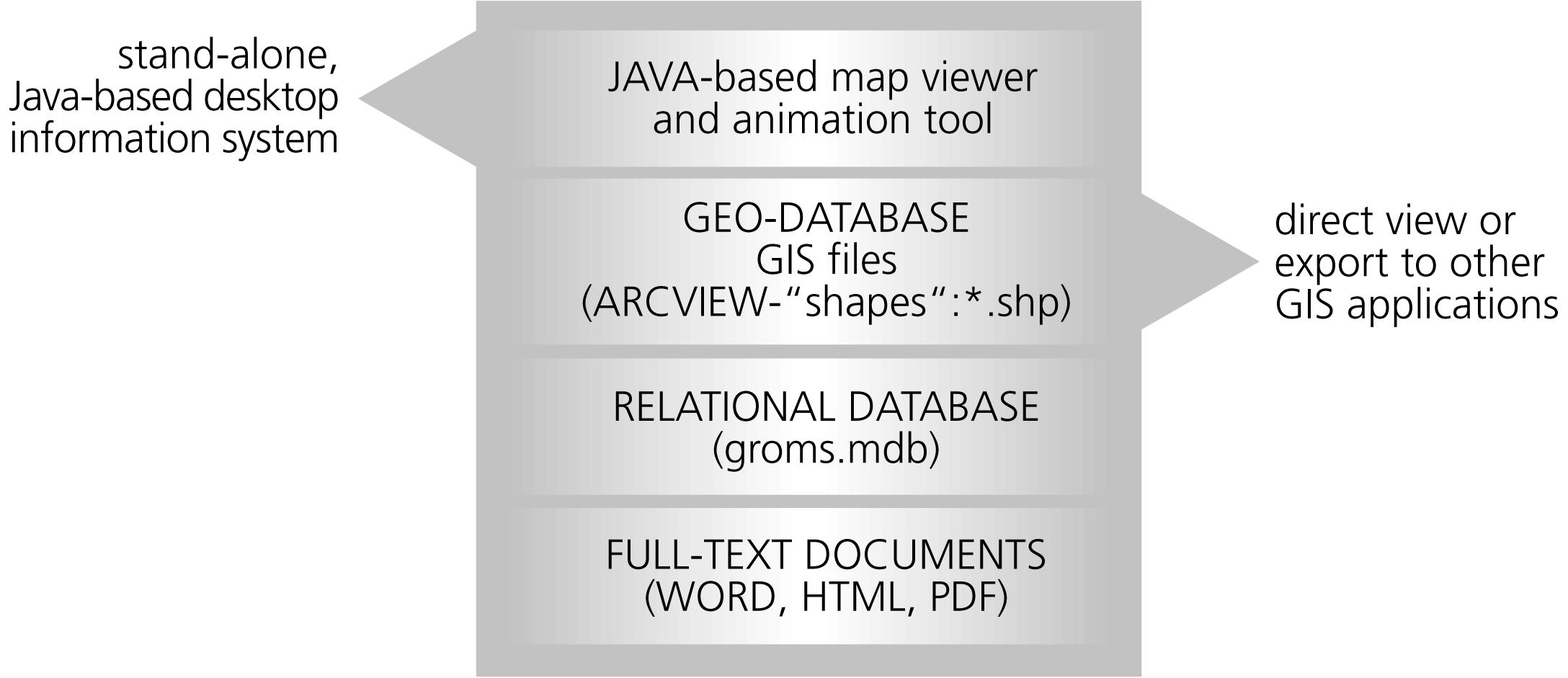
Both versions should be easy to use for a broad variety of users, but in particular for conservationists, scientists and decision makers. Taking into account these constraints, the following software components were selected (Figure 3.1.).
|
Fig. 3.1: Main components of the GROMS information system and content of the CD. The database and GIS maps were generated by standard software, and files can be accessed directly by the user with the respective software. Java-based tools provide access to GIS data without additional GIS-software. Technical details and an installation guide are accessible by clicking on "groms.html" on the GROMS-CD. The Internet version is accessible via http://www.groms.de. |
Abb. 3.1: Wesentliche Komponenten des GROMS-Informationssystems und Inhalt der CD. Zur Erstellung von Datenbank und GIS-Karten wurde weit verbreitete Standardsoftware verwendet, mit der der Nutzer direkt auf die Inhalte zugreifen kann. Darüber hinaus erlauben plattformunabhängige Java-Programme eine Darstellung von Karten ohne zusätzliche GIS-Software. Technische Detailinformationen und Installationsanleitung sind über das Dokument "groms.html" auf der GROMS-CD abrufbar. Eine Web-Version des Java-Auskunftsplatzes ist über http://www.groms.de zugänglich. |
| 21 | http://www.groms.de/ |
| 22 | Examples and instructions are accessible by opening the groms.html file on the CD |
| Database design | < Main components of the GROMS information system > | Integration of geodata |
This document should be quoted as part of the publication "Riede, K. (2001): The Global Register of Migratory Species Database, GIS Maps and Threat Analysis. Münster (Landwirtschaftsverlag), 400 pp." + CD
by Klaus Riede